Geophysical survey at Tarragona
Geophysical survey at Tarragona, and the constraints of modern urban areas
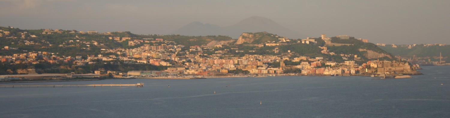
Over the past few months of field survey, work has swung around to a series of projects lined to Roman ports in the Mediterranean. In June and July I headed back for a season of excavations at Portus, and in August and September geophysical survey at the site of Ephesus in Turkey (more on this in a future post). In October and November work has commenced on a geophysical and topographic survey of the Roman port area of the town of Tarragona in Catalonia, Spain. The work, together with that of Ephesus, forms part of the Roman Meditteranean Ports (RoMP) project, or Portuslimen. A component of this project involves the survey of a number of port sites, to understand the form and extent of these sites, and help analyse the ways in which they may have functioned through time. The work at Tarragona is being conducted in collaboration with colleagues from l’Institut Català d’Arqueologia Clàssica (ICAC).
The issue with Tarragona is that the development of the town and port spans from the pre-Roman period, to the establishment of the Roman town in the third century BC, to Late Roman and Visigothic settlement in the 6th, 7th and 8th centuries, and later Islamic influence. Over this time the town and its port expanded and contracted, and archaeological deposits were buried under fluvial deposits from the Francolí river to the west of the port. Later post-medieval expansion of the town, particularly in the 19th and 20th centuries saw much of the Roman and later port built over, and a new harbour constructed over the remains of the ancient port. The aim of our survey is to attempt to locate significant structural remins of the Roman port and harbour through intrusive methods. The good news is that a number of areas in the city have been excavated in the past 40 years, which helps in the location of the survey to gain as much as possible from the efforts. The bad news is that, due to the modern town plan, many of the survey areas are constrained by modern buildings and infrastructure. Thus our work has to use some specific techniques to conduct survey in the areas that are available. This includes topographic survey and location of survey grids using RTK GPS and total station survey, and use of GPR and ERT along streets and in plazas to map buried remains.
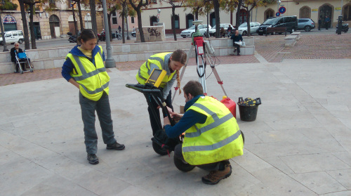
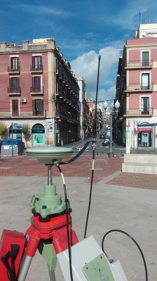
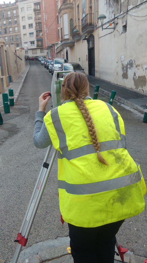
Fortunately for the University of Southampton team, the open plazas of the town provided sufficient space for static data to be collected by the GPS base station, and for a series of preliminary stations to be established using the GPS. Where the streets became narrow a total station was used to establish further stations in a traverse around the port area of the town.
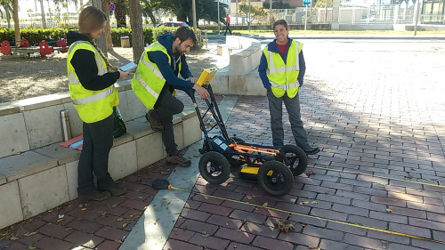
Geophysical survey s far has focused on 500MHz GPR, propagating 3-4m below the modern street level to find the buried archaeology. In some of the streets in the northern part of the port area, particularly along the roads close to the Roman baths and theatre a number of walls and other features are visible. As the survey progresses southwards, however, modern infrasructure such as manhole covers, and the nature of the made-up ground close to the modern harbour, make the results more difficult to interpret. The restrictions in terms of spatial coverage have also provided a challenge in terms of data interpretation.
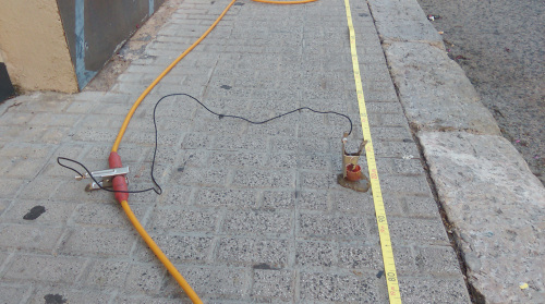
To better understand the geoarchaeology of the site we have been applying Electrical Resistivity Tomography (ERT) to record both archaeology and deeper deposits in the town. The main constraint with this is that the paved areas of the town preclude the use of survey probes (these cannot be dug through cement and Tarmac). Thus we have had to adapt using a system of electrode copper conductors and a conductive gel. Most surfaces will allow an electrical current to be passed through them, but asphalt and Tarmac act as insulators, meaning that for the ERT to work long stretches of cement pavement need to be surveyed.
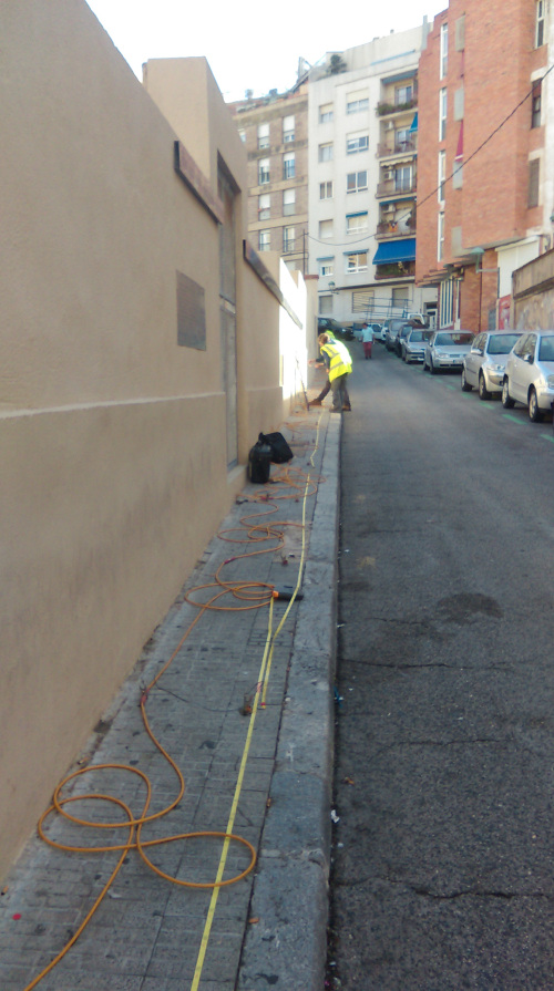
In spite of our initial misgivings, the conductors and gel, with the ERT equipment, have proved to work very well indeed. The profile alongside the Roman theatre has revealed a number of areas of walls and rubble aligned adjacent to the excavated theatre remains. The team hope to conduct a long profile of ERT in the southern part of the modern port which, together with the boreholes of Ferreol Salomon, will investigate the nature of the harbour deposits.
The survey work is being conducted until 15th November, and there are many features of the topography of the ancient harbour that remain to be discovered, including the line of the Roman seafront and mole.
By Kristian Strutt (University of Southampton)