Pitane
Historical background
By E. Laufer, F. Pirson
The ancient harbour city of Pitane is well-known as one of the famous 12 Aeolian colonies mentioned in Herodot (I 149), well attested as a polis also for the Hellenistic and the Roman period (cf. Keil 1950).
Archaeological background
By E. Laufer, F. Pirson
Most of the promontory with the ancient city of Pitane is today overbuilt by the Turkish harbour city and tourist resort Çandarlı. Already the travellers in the 19th century had noticed only rare remains of the ancient city (cf. e.g. Schuchhardt 1913: 99 f.) nearly all of which have gone today. An excavation by E. Akurgal (cf. Akurgal 1960) in the necropolis of the city remained partly unpublished. Some current rescue excavations in the city are conducted by the Museum of Bergama.
In 2015, a team of the „Kane Regional Harbour Survey” (cf. the site of Kane) started archaeological fieldwork in Pitane (Laufer forthcoming). The research was focussed on pottery studies and geophysical studies in the central urban area (today a zone of olive groves). The importance of Pitane as a commercial harbour in Roman times is clearly indicated by the intensive production of terra sigillata (ESC/so-called ‘Çandarlı ware’) which must have been exported via the city’s harbour to the Eastern Mediterranean. The general topography of the ancient harbour is still preserved in the modern harbour bay, but the ancient mole ist totally covered by a modern one.
The „Kane Regional Harbour Survey” is part of the Portus Limen Network and funded by the ERC.
Archaeological Survey: members of German Archaeological Institute, University Bochum, University of Cologne, Technical University Regensburg, University Munich, University Izmir; Karlsruhe Institute of Technology (Geodesy).
Geophysics: University Southampton/British School at Rome.
Geomorphological background
By E. Laufer, F. Pirson
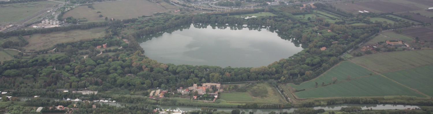
Pitane is situated on the southern coast of the mountainous Kane Peninsula (today Karadağ Peninsula) ca. 30 km west of Pergamum. The ancient city covered a flat promontory of volcanic rock with a length of ca. 1200 m (north-south) and a maximal width of ca. 450 m. It is flanked by two bays to the east and west; the artificially formed harbour basin is situated in the western bay.
Importance in the Roman harbour network
Cf. Kane
References
- Akurgal 1960: E. Akurgal, Çandarlı (Pitane) kazısı, Türk Arkeoloji Dergisi 10/1, 1960, 5-6.
- Keil 1950: Paulys Realencyclopädie der classischen Altertumswissenschaft vol. XX,2 (Stuttgart 1950) 1842-1843 s. v. Pitane (J. Keil).
- Laufer forthcoming: E. Laufer, Survey auf der Kane-Halbinsel (Kane Regional Harbour Survey) 2015, in: F. Pirson, Pergamon – Bericht über die Arbeiten in der Kampagne 2015, AA 2016/2 (forthcoming).
- Schuchhardt 1913: C. Schuchhardt in: A. Conze – O. Berlet – A. Philippson u. a., Stadt und Landschaft, Altertümer von Pergamon vol. I,1 (Berlin 1913).